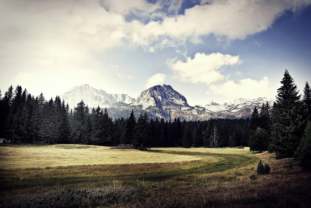
Shavnik and Sinjavina: the untouched highlands of central Montenegro
History and Context
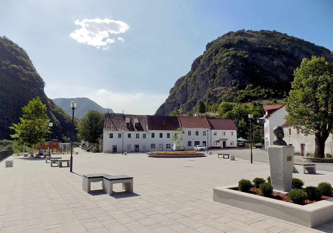
Shavnik is the administrative center of the homonymous municipality and the smallest town in Montenegro, with a population of around 2,000 people. {GOOGLE=42.9553,19.0947} It is located in a narrow valley along the Bukovica river at an altitude of 820 meters, surrounded by mountains on all sides. There are no traffic lights here, but instead, you can enjoy some of the most rugged and beautiful landscapes in the Balkans.
The Sinjajevina plateau {GOOGLE=42.9833,19.2000} is the largest mountain pasture in Europe, covering nearly 500 square kilometers of flat, slightly undulating grasslands at altitudes of 1,600–2,277 meters. The name “Sinjajevina” means “blue,” and indeed, these mountains look blue from a distance. For centuries, this plateau has been used as a summer pasture; herders would bring their families here in June and return in September. This tradition continues to this day, and you will see herds of cows and sheep, stone enclosures, and wooden huts scattered across the vast grasslands.
During World War II, the Sinjajevina plateau was the site of fierce battles between partisans and the occupying forces. Memorial markers and remnants of fortifications can still be found there today. The area is now seeking to be designated as a protected natural park, and environmental organizations are working to have Sinjajevina recognized as a UNESCO World Heritage Site.
How to Get There
Shavnik isn’t an easy place to reach by public transport. But precisely that is part of its charm.
By car from Podgorica
The distance is 130 km, and the travel time is about 2.5 hours along the road passing through Nikšić. The M18 highway takes you 65 km (about an hour) to Nikšić, and then the regional road R-5 leads through the Komarnica canyon to Shavnik. The last section is a winding road with stunning views, but it’s narrow, so be careful at the turns. Car rental in Podgorica costs around 20–30 EUR per day.
From Žabljak
The distance is only 40 km, and the drive takes about 50 minutes along a road passing through the village of Tušinja. The route is beautiful, but some sections lack markings and barriers.
By bus
Reaching the Sinyavina plateau
There is no public transport available directly to the plateau. You need a car, preferably with a high ground clearance—the dirt roads on the plateau are passable for a regular car in dry weather, but they turn into muddy messes after rain. Locals usually use off-road vehicles or tractors to get there. The main access routes are from Shavnik via Motički Gaj or from Kolashin via the Krstac pass.
What to see
The Sinyavina plateau: Mount Babin Zub (2,277 m)
The highest point of the plateau and one of Montenegro’s most prominent peaks. {GOOGLE=42.9667,19.2667} It takes 2–3 hours to walk from the road to the plateau through open grasslands; there are no technical difficulties involved. From the summit, you can enjoy a panoramic view of Durmitor, Komovi, Belasica, and even Prokletie on clear days. The signage is poor, so be sure to bring a GPS navigator or an offline map (such as maps.me or OsmAnd).
Catuunes in Sinjavina
Scattered across the plateau are summer settlements for shepherds, consisting of stone houses with wooden roofs. {GOOGLE=42.9900,19.1800} In July and August, families living here will offer you homemade kaymak, cheese, and sour milk. While they usually don’t ask for money, it is polite to leave 5–10 EUR as a tip. The most picturesque catuunes can be found in the areas of Savino Lakt and Jablanova Poljana.
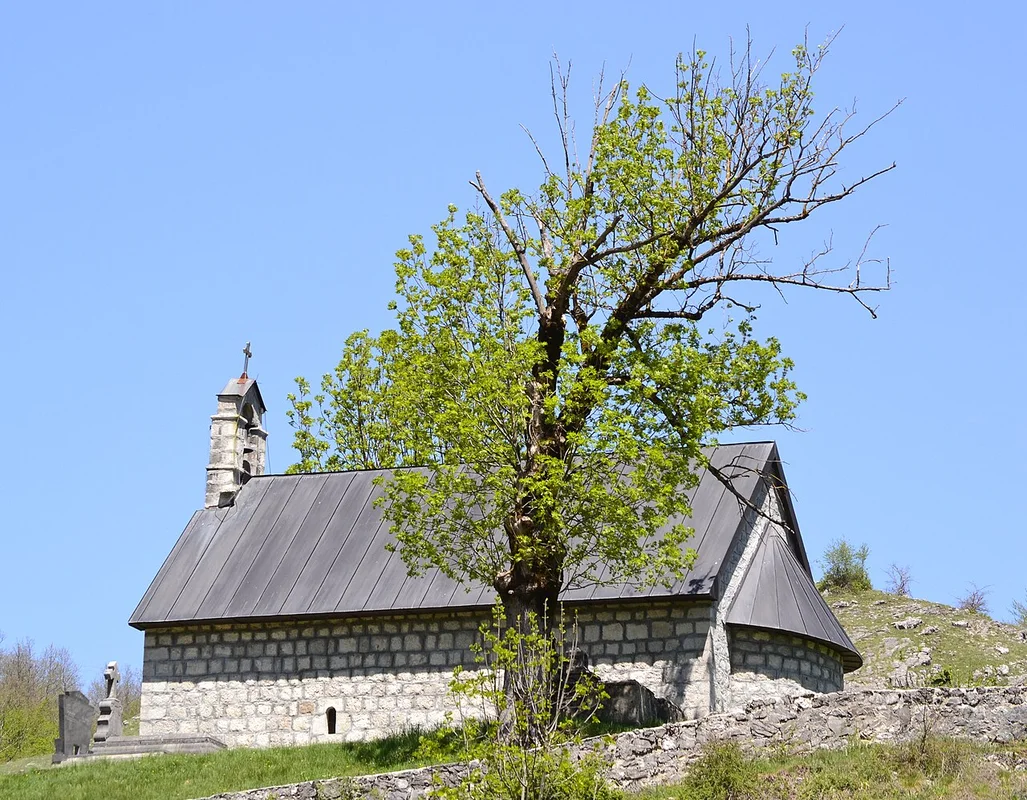
Monastery of Podmalinsko
A medieval Orthodox monastery from the 14th century, located in a gorge along the Bukovica river, 3 km away from Shavnik. {GOOGLE=42.9480,19.0830} This small but atmospheric church is set among rocks and is open to the public for free. The local priest sometimes leads guided tours.
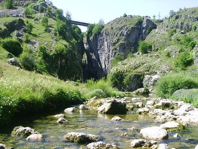
Comarnica River Canyon
A deep canyon on the road to Shavnik, located near Nikšić. ⟪3⟞ It is approximately 15 km long and up to 600 m deep. The road winds along the edge of the canyon; the views are breathtaking, but drivers won’t have time to take photos. It’s best to stop at one of the viewing spots (there are 2–3 areas where the road widens, providing parking space).
Shavničko Lake
A small mountain lake located 7 km east of the town. ⟪4>>
When to go
The best season is from mid-June to mid-September. During this time, the dirt roads on the plateau are passable, the mountain huts are inhabited, and the weather is ideal for hiking. The peak months are July and August, when the meadows are in full bloom and temperatures at an altitude of 1,600 meters range around 15–20°C during the day.
In winter, Shavnik is covered with up to 2 meters of snow, and the roads on the plateau are closed from November to May. During the off-season (May, October), the weather is unpredictable; snowstorms are possible even in early June.
Accommodation
In Shavnik, there are 2–3 small guesthouses and several options available on Booking.com. The average price for a two-person room is 25–40 EUR. I recommend “Etno selo Šavnik” – wooden cottages with views of the mountains, starting from 35 EUR per night. There is no accommodation on the Sinyavina plateau itself; only camping is possible.
Food
In Shavnik, there are 2–3 restaurants and cafes. “Konoba kod Žarka” on the main street serves traditional Montenegrin cuisine: lamb stew (8–12 EUR), cheese cake with cream (4–5 EUR), grilled trout (6–8 EUR). Hours of operation are approximately 08:00–22:00, but they may close earlier during the off-season. There is one grocery store in the entire town, open from 07:00–20:00 (until 14:00 in summer). No stores are available on the plateau; bring all your necessities with you.
Activity prices
There are no entrance fees; the entire area is open to visitors. If you need a local guide for hiking on the plateau, you can arrange one through the guesthouses in Shavnik at a cost of 30–50 EUR per day. Renting an off-road vehicle with a driver (for the round trip from Shavnik to the plateau) costs around 60–80 EUR.
Tips for tourists
What to bring definitely:
- Offline maps (maps.me or OsmAnd)—mobile coverage on the plateau is almost non-existent.
- Warm clothing—even in July, temperatures at 2,000 meters can drop to 5°C at night.
- Jacket and raincoat—the weather on the plateau changes rapidly.
- Adequate water (at least 2 liters per person)—there are few water sources, and not all of them are marked.
- Trekking shoes—the grassy areas seem flat, but rocks are often hidden under the vegetation.
- Sunscreen with SPF 50—ultraviolet radiation is much stronger at high altitudes.
- A full tank of gasoline—the nearest gas stations are in Nikšić (60 km) or Žabljak (40 km); there are no gas stations in Shavnik.
What to avoid:
- Do not drive on the unpaved roads of the plateau after heavy rain—your car will get stuck for sure.
- Do not walk on the plateau in fog without a GPS—it’s hard to navigate, and getting lost is easy.
- Do not approach herding dogs—the Sharplaninians protect their flocks and may be aggressive towards strangers. Stay at least 50–100 meters away from the herds.
- Do not rely on mobile internet—download all maps and necessary information in advance.
Tip: Shavnik is an excellent base for visiting the Durmitor national park—Žabljak is just 40 minutes away. Consider spending 2–3 days here: one day on the Sinyavina plateau, another exploring the Komarnica canyon and its surroundings, and then heading to Durmitor. This way, you’ll experience two completely different aspects of Montenegro’s highlands.
Find the Best Professionals for Your Project
Expert repair, construction, and renovation specialists ready to help you right now
Recommended articles
Tarasova Hora in Kanev: Shevchenko's grave overlooking the Dnieper – how to get there, what to see, practical tips
Mezhigorye: A Museum of Corruption Near Kiev – How to Get There, What to See, and How Much It Costs
Dnieper Promenade and the monastery on the island: walks by the water in the city of Dnipro
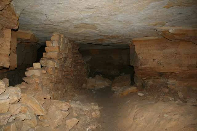
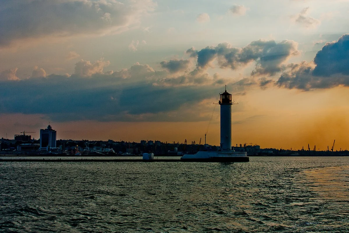
The Odessa Catacombs and Privoz Market: an underground world with a vibrant market atmosphere
More articles:
- Tarasova Hora in Kanev: Shevchenko's grave overlooking the Dnieper – how to get there, what to see, practical tips
- Mezhigorye: A Museum of Corruption Near Kiev – How to Get There, What to See, and How Much It Costs
- Dnieper Promenade and the monastery on the island: walks by the water in the city of Dnipro
- The Odessa Catacombs and Privoz Market: an underground world with a vibrant market atmosphere
 Odessa: Deribasivska Street and the Opera House – a city of cinema and humor
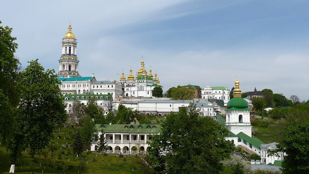 Gastronomic Kiev: Vareniki, Borsch, and Craft Beer – Where to Eat Like a True Ukrainian
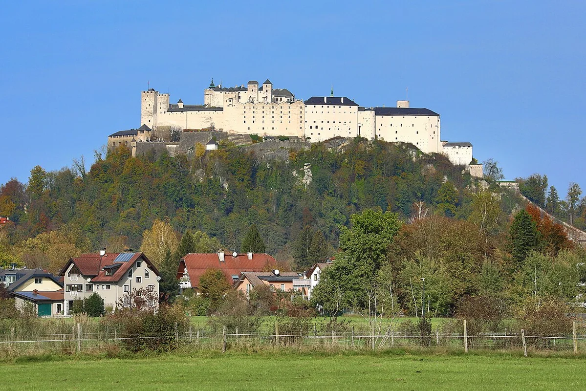 Mönchsberg and the cable car: a panorama over Salzburg that takes your breath away
 Swarovski’s Crystal World in Wattens: A comprehensive guide to Austria’s most dazzling museum