Where does the Poltava Road lead?8 photos
Where Does the Poltava Road Lead?
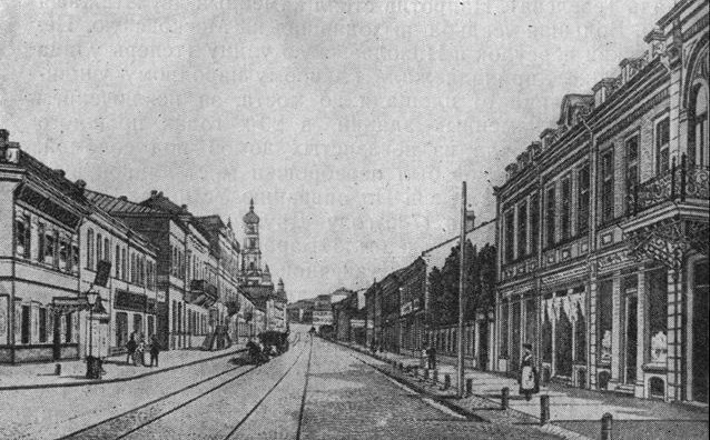
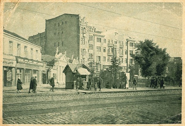
This street emerged in the last quarter of the 17th century as a route to Poltava, and for that reason it was long called Poltava Street. In the second half of the 18th century, it served not only as a road to Poltava but also extended all the way to the Novorossiysk region and later to Yekaterinostav (now Dnipropetrovsk). Accordingly, the street’s name changed several times.
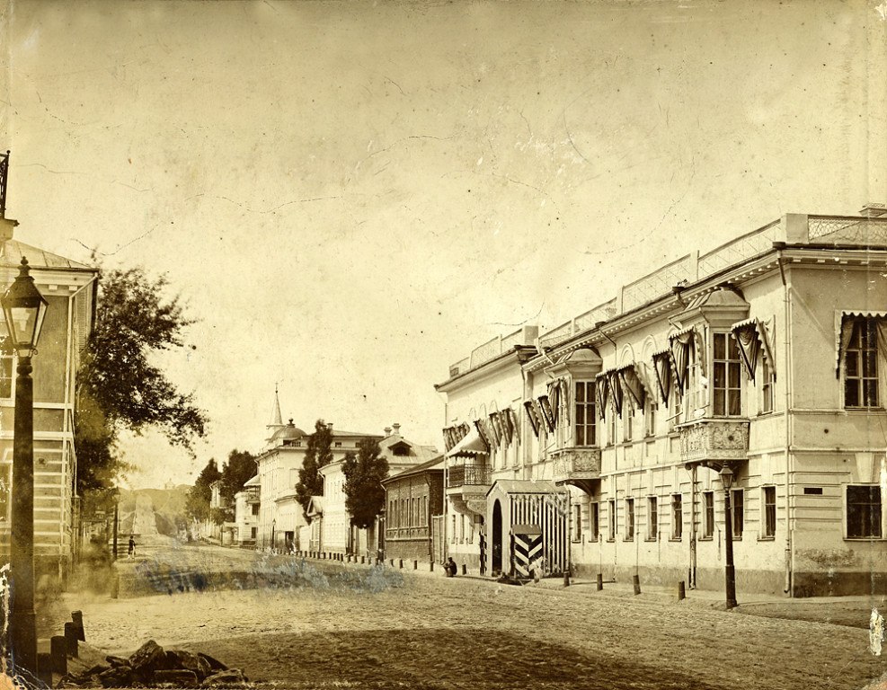
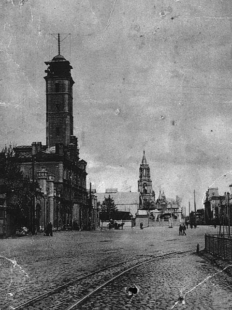
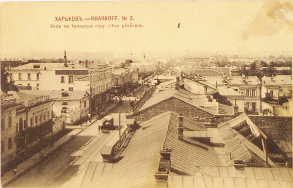
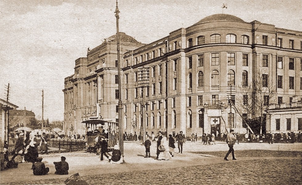
At the turn of the 18th and 19th centuries, the haphazard development in this area began to take on a more organized form. In 1804, a checkpoint was established at the end of Yekaterinostav Street, at the entrance to the city (in the area of today’s Marshal Malinovsky Street). Starting in 1837, in accordance with the “Regulations on the Organization of the Governorate City of Kharkov,” stone buildings—two- and three-story structures in the tradition of Russian classicism—began to be constructed along Yekaterinostav Street. In the 1850s, at the order of Governor General S.A. Kokoshkin, the area from Lopansky Bridge to today’s Malinovsky Street was leveled and paved; a lake that crossed this section near Lopan was filled in (the Round Square on Poltava Road). Around the same time, the road leading up to Kholodnaya Gora, which was now part of the city limits, was also improved.
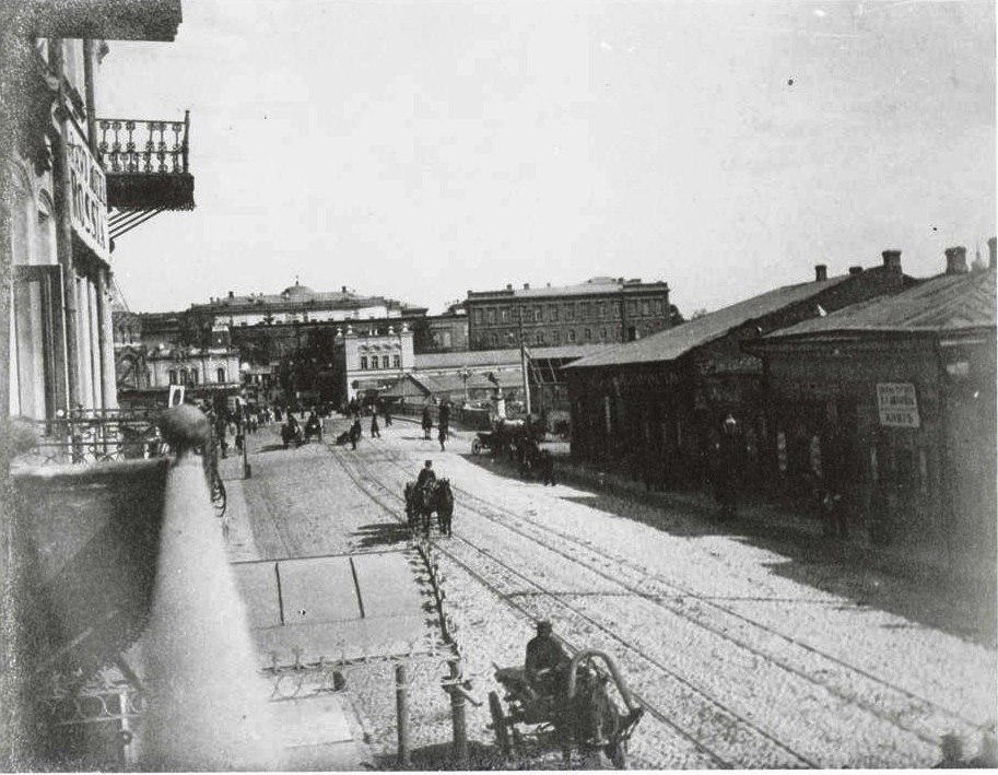
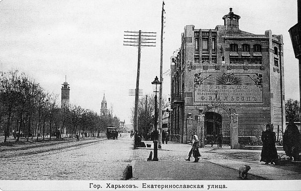
Construction on Kholodnaya Gora accelerated in 1869 with the opening of the Azov-Kursk Railway and the construction of the train station. Once again, Yekaterinostav Street assumed its primary function as a route to and from the train station, connecting it to the city center. In 1880, a large secondary water reservoir for Kharkov’s water supply system was built on this elevated section of the street; water was pumped here from the Karpovsky Spring. By the turn of the 19th and 20th centuries, four- and six-story buildings in eclectic and modern architectural styles began to appear along the street.
Source: vk.com/old_kharkov
#Kharkov #History_of_Kharkov #1stolica_history
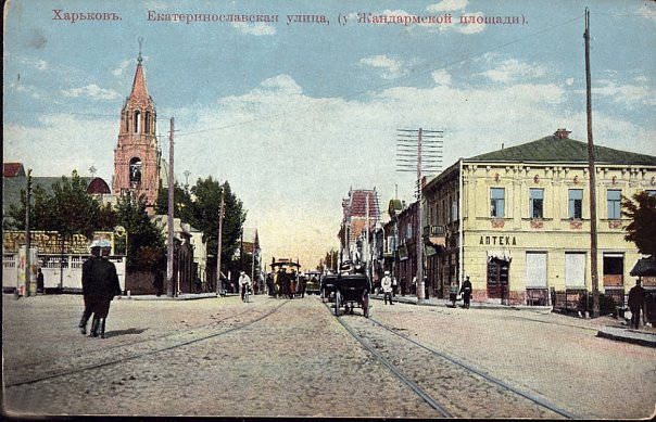
This street emerged in the last quarter of the 17th century as a route to Poltava, and for that reason it was long called Poltava Street. In the second half of the 18th century, it served not only as a road to Poltava but also extended all the way to the Novorossiysk region and later to Yekaterinostav (now Dnipropetrovsk). Accordingly, the street’s name changed several times.
At the turn of the 18th and 19th centuries, the haphazard development in this area began to take on a more organized form. In 1804, a checkpoint was established at the end of Yekaterinostav Street, at the entrance to the city (in the area of today’s Marshal Malinovsky Street). Starting in 1837, in accordance with the “Regulations on the Organization of the Governorate City of Kharkov,” stone buildings—two- and three-story structures in the tradition of Russian classicism—began to be constructed along Yekaterinostav Street. In the 1850s, at the order of Governor General S.A. Kokoshkin, the area from Lopansky Bridge to today’s Malinovsky Street was leveled and paved; a lake that crossed this section near Lopan was filled in (the Round Square on Poltava Road). Around the same time, the road leading up to Kholodnaya Gora, which was now part of the city limits, was also improved.
Construction on Kholodnaya Gora accelerated in 1869 with the opening of the Azov-Kursk Railway and the construction of the train station. Once again, Yekaterinostav Street assumed its primary function as a route to and from the train station, connecting it to the city center. In 1880, a large secondary water reservoir for Kharkov’s water supply system was built on this elevated section of the street; water was pumped here from the Karpovsky Spring. By the turn of the 19th and 20th centuries, four- and six-story buildings in eclectic and modern architectural styles began to appear along the street.
Source: vk.com/old_kharkov
#Kharkov #History_of_Kharkov #1stolica_history
Find the Best Professionals for Your Project
Expert repair, construction, and renovation specialists ready to help you right now
Recommended Galleries
Recommended articles


More Galleries
 The Southern Railways Management Office was a precursor to the State Planning Commission.
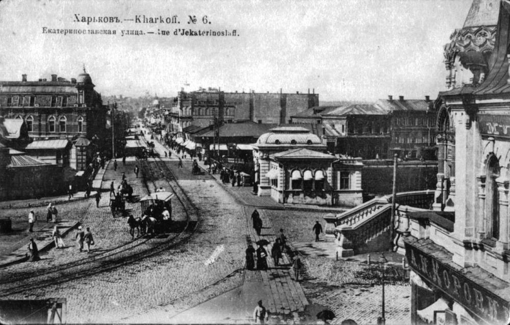 Old Bridges of Kharkiv
 Light Gardens of Kharkiv – Shevchenko Park T.G. Shevchenko – University Park.
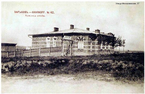 Former nursery school, radio tower with noise suppressor<br>and the building of the 6th Polyclinic
 The Wedding Palace – A.A. Yuzefovich’s mansion – is celebrating its 100th anniversary this year.
 Shatilovka was once a suburban area of Kharkiv that became part of the city limits in the early 20th century.
 In Zagospromy, houses were built without kitchens, and writers were executed.
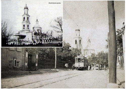 #### Mikhailovskaya Church
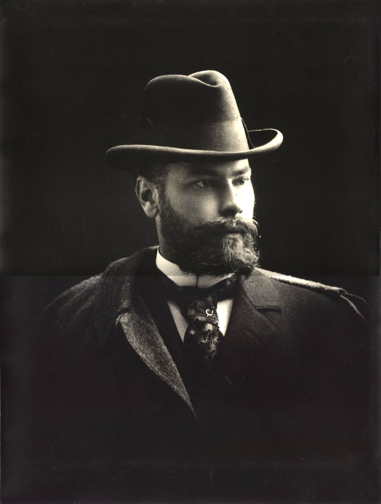 Alexey Nikolaevich Beketov<br>(An architect who can rightfully be called<br>the central figure of Kharkiv's architectural tradition.)
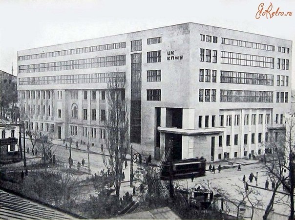 The Triumph of Constructivism --- Return ONLY the complete translated text.
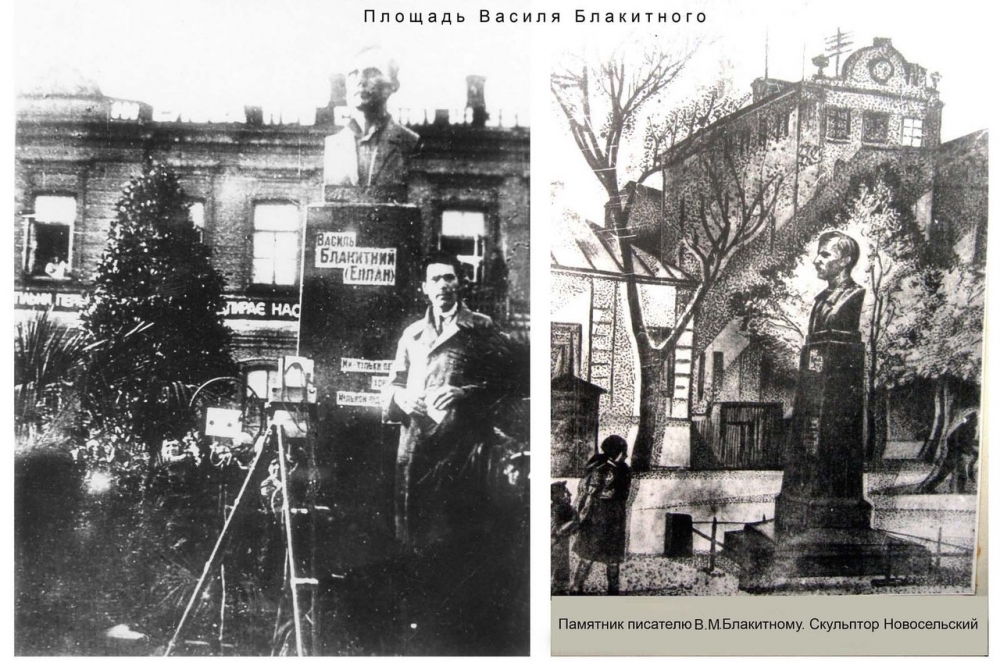 Monument to V.M. Blakitny on Chernyshevskaya Street
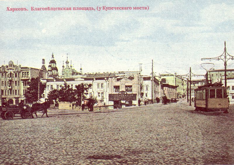 Blagoveshchensky Market