[club1643502|Main Street]. Ulica Sumska powstała wraz z budową twierdzy w Charkowie jako droga prowadząca do miasta Sumy.6 zdjęć
Rozpoczęta w końcu XVII wieku zabudowa wzdłuż drogi dotarła do końca XVIII wieku do obecnego Placu Teatralnego, gdzie wtedy przechodził okolniające miasto ziemienny wał. Rozkwit budownictwa nastąpił na początku XIX wieku po wybudowaniu drogi pomiędzy Charkowem a Kurskim. W miejsce glinobitnych domów z solomianymi dachami zaczęły powstawać domy urbanistycznego charakteru, a od 1836 roku zabraniano budować inne niż kamienne budynki. W 1839 roku ulica została wybrukowana, a rok później oświetlona 37 olejnymi lampami. System numeracji domów, zastępujący wcześniejszą nazewanie według właścicieli, wdrożony został w 1869 roku. Numery rozpoczинаły się od strony centrum miasta. Do 1879 roku pierwszy numer przypadał na teren obecnego Placu Pokoju, gdzie znajdowała się cerkwa Mironosic, a drugi номер – na teren Weterinarnego instytutu, gdzie obecnie znajduje się Dom dziecięcej i młodzieżowej twórczości. Na wschodniej stronie ulicy numery były nieparne, a na zachodnej – parne. W wrześniu 1883 roku opened the horse-drawn railway line along Sumskaya street, connecting the southern part of the city with the former Veterinary Square (Svoboda Square). Na rozgraniczeniu XIX i XX wieku rozpoczęło się osiedlanie w północnej części dzielnicy Nagornoje, gdzie głównie budowano wielokondyktoryne mieszkania, a także powstał miejski park. W 1906 roku do parku została przechodona tramvaj linia z ulicy Puszkina przez former Bassein (Petrovskogo street) i Sumskaya street. Konie i tramwaje zostały entfered from Sumskaya street after 1917, and in 1939 the first trolleybuses in Ukraine passed along it; their depot was temporarily located on the former Mironosic Square (now Pokoj Square). The significance of Sumskaya street as the city’s main avenue developed gradually. Its location along the ridge of the upland that separates the floodplains of the Kharkov and Lopan rivers, as well as the presence of southern extensions of the forest massif, contributed to the creation of recreational green spaces in the early 19th century: the University Garden (now Shevchenko Garden), later the City Park and the Forest Park (Sokolniki-Pomerki). The oldest surviving buildings on Sumskaya street are two-story residences at number 16, constructed in the 1840s when so-called model projects designed in the style of untidy classicism were mandatory. In 1842, on Teatralny Square, according to the design of architect A.A. Ton, was built a stone building for the dramatic theater (now the Shevchenko Theater after several renovations). At the southern edge of the University Garden, in the 1840s, were located the Institute for Noble Ladies and the Merchant Assembly House; later, on their site was built a new opera house. Opposite these buildings stood the former cemetery church, later converted into the Cross-Raising Church, also known as the Women’s Miracle Workers Church, which was demolished in the 1930s. In the second half of the 19th century were constructed the buildings of the Veterinary Institute and the medical faculty of the university. At the turn of the 19th and 20th centuries, on the corner of Teatralny Square, according to the design of architect R.P. Golenishchev, was built a monumental building for the State Bank, which in 1932 was expanded by two additional floors designed by architects A.N. Beketov and V.N. Peti. At the same time, on lots numbers 18–20, according to the designs of architect B.G. Mikhailovsky and brothers S.I. and I.I. Zagoskin, was built the building of the Southern Russia Mining Industry Workers’ Council (now the Radio Technology School). On the corner of Veterinary Street and Ivanova Street was the building of the provincial government office, designed by architect A.B. Minkus, which was expanded in 1913 according to the design of architect V.V. Velichko and renovated in 1930 (according to the design of architect Y.A. Steynberg) to accommodate the Central Committee of the Communist Party of Ukraine. After the war, in the 1950s, on the site of this building was constructed an administrative office building, which stands today. At the corner of the former Hospital Alley and Danilevsky Street was built in 1889–1992, with the participation of architect F.I. Shuster, the School for the Blind. Between them, numerous respectable residential buildings also arose one after another. Among them stood out: building at number 47, which was originally a professor Neznamov’s mansion but was later altered in construction; the house of the newspaper “Southern Border” publisher A.A. Iozefovich, where now befinds itself the Wedding Palace (architect A.I. Gorochov, 1913); as well as numerous prestigious apartment buildings. In particular, the buildings at numbers 17 and 44 stood out for their luxury and elegance. Building number 17, belonging to the “Salamandra” insurance company, was designed by architect N.N. Berevkin (1914–1915); building number 44, owned by the noblewoman Aladina, was designed by architect Yu.S. Caunee (1912). Buildings numbers 82 and 84 belonged to the merchant Moshevich; the architecture of building number 82 was designed by architect V.A. Estrovic. The buildings on Sumskaya street are not only important from an architectural point of view but also hold great historical value. They reflect the various stages of our city’s history since the 19th century until today, as well as the evolution of architectural styles and trends. Traditionally, Sumskaya street has been a popular place for leisure and recreation among the locals. The theaters, cinemas, shops, cafes, restaurants, and especially the parks and squares located along it have always attracted many people. In the 1930s, the establishment of the new public center – Freedom Square (formerly Dzerzhinsky Square) – further enhanced the significance of this street. In 1935, a monument to T.G. Shevchenko was erected on this street, which became a sacred place for the locals. The new opera house also attracted many visitors. However, the increasing traffic volume, which far exceeded the street’s capacity, caused significant problems. In recent years, efforts have been made to reduce traffic congestion by diverting vehicles to bypass roads and gradually restoring the street to its original human-scale character. These measures are yielding some positive results, but transforming the initial section of the street into a pedestrian zone is still not feasible at present. Nevertheless, Sumskaya Street remains the beloved favorite of the citizens of Kharkov and continues to be the face of our city.
**Alexander Liebfreid, Candidate of Architecture. Tatiana Tikhomirova, Local Historian. ("Sloboda" magazine, issue 31, April 1993).** #Kharkov #History #Ukraine
![[club1643502|Main Street]. Ulica Sumska powstała wraz z budową twierdzy w Charkowie jako droga prowadząca do miasta Sumy. - 1](/storage/images/mixx/2013-11/d59013d63d3aa042.jpg)
![[club1643502|Main Street]. Ulica Sumska powstała wraz z budową twierdzy w Charkowie jako droga prowadząca do miasta Sumy. - 2](/storage/images/mixx/2013-11/a4b96a3f6422daa7.jpg)
![[club1643502|Main Street]. Ulica Sumska powstała wraz z budową twierdzy w Charkowie jako droga prowadząca do miasta Sumy. - 3](/storage/images/mixx/2013-11/6088c38f44565f7d.jpg)
![[club1643502|Main Street]. Ulica Sumska powstała wraz z budową twierdzy w Charkowie jako droga prowadząca do miasta Sumy. - 4](/storage/images/mixx/2013-11/edb661cc6206c676.jpg)
![[club1643502|Main Street]. Ulica Sumska powstała wraz z budową twierdzy w Charkowie jako droga prowadząca do miasta Sumy. - 5](/storage/images/mixx/2013-11/fb082c8739000e8e.jpg)
![[club1643502|Main Street]. Ulica Sumska powstała wraz z budową twierdzy w Charkowie jako droga prowadząca do miasta Sumy. - 6](/storage/images/mixx/2013-11/0ff426a58567fe78.jpg)
Znajdź najlepszych specjalistów dla swojego projektu
Specjaliści od remontów, budowy i wykończeń gotowi Ci pomóc
Polecane galerie
Polecane artykuły


Więcej galerii
![[club1543502|Alley Worobiyewa przyciąga nie tylko kinomaniów, ale także terroryści].](/storage/images/mixx/2013-11/731fc2dbacb3def7.jpg) [club1543502|Alley Worobiyewa przyciąga nie tylko kinomaniów, ale także terroryści].
[club1543502|Alley Worobiyewa przyciąga nie tylko kinomaniów, ale także terroryści].![[club1543502|Dom Złotej Rybki albo <br>drugi dom w Charkowie z chimery] <br>(po prawej stronie od teatru im. Szekspira).](/storage/images/mixx/2013-11/f2d233c7e996c711.jpg) [club1543502|Dom Złotej Rybki albo <br>drugi dom w Charkowie z chimery] <br>(po prawej stronie od teatru im. Szekspira).
[club1543502|Dom Złotej Rybki albo <br>drugi dom w Charkowie z chimery] <br>(po prawej stronie od teatru im. Szekspira).![[club1543502|Harwick House na ulicy z chimery]](/storage/images/mixx/2013-11/666e76242d7674a6.jpg) [club1543502|Harwick House na ulicy z chimery]
[club1543502|Harwick House na ulicy z chimery] Ilustracje z książki „Charkiwщина” z 1981 roku.
![[club53611948|Charków, który utraciliśmy: jeden z dwóch domów należących do tej same rodziny, z których wywodzi się nazwa ulicy Darwina].](/storage/images/mixx/2013-11/ee0e31f40f90c65f.jpg) [club53611948|Charków, który utraciliśmy: jeden z dwóch domów należących do tej same rodziny, z których wywodzi się nazwa ulicy Darwina].
[club53611948|Charków, który utraciliśmy: jeden z dwóch domów należących do tej same rodziny, z których wywodzi się nazwa ulicy Darwina]. Byłe mieszkanie przy ulicy Aleja Adalina.
![[club1543502|Dom „Czerwony Żygiewicz”].](/storage/images/mixx/2013-11/991946050ce42109.jpg) [club1543502|Dom „Czerwony Żygiewicz”].
[club1543502|Dom „Czerwony Żygiewicz”].![[club1543502|Aleja Ludwika Świętożytnego].](/storage/images/mixx/2013-11/f94298965045d62d.jpg) [club1543502|Aleja Ludwika Świętożytnego].
[club1543502|Aleja Ludwika Świętożytnego]. [club1543502|Jedna z najstarszych budynków w Charkowie.
![[club1543502|Suzdalski Gostiny Dwór].](/storage/images/mixx/2013-11/2c9f72a870f8a7fd.jpg) [club1543502|Suzdalski Gostiny Dwór].
[club1543502|Suzdalski Gostiny Dwór]. Rezerwaty dzikiej przyrody. Miasto Lüneburg, Niemcy.
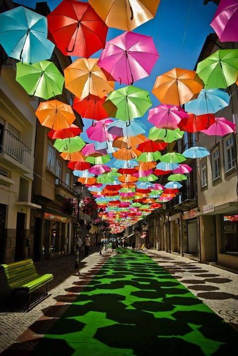 Kolorowe parasolki na ulicach Agedy, w Portugalii.