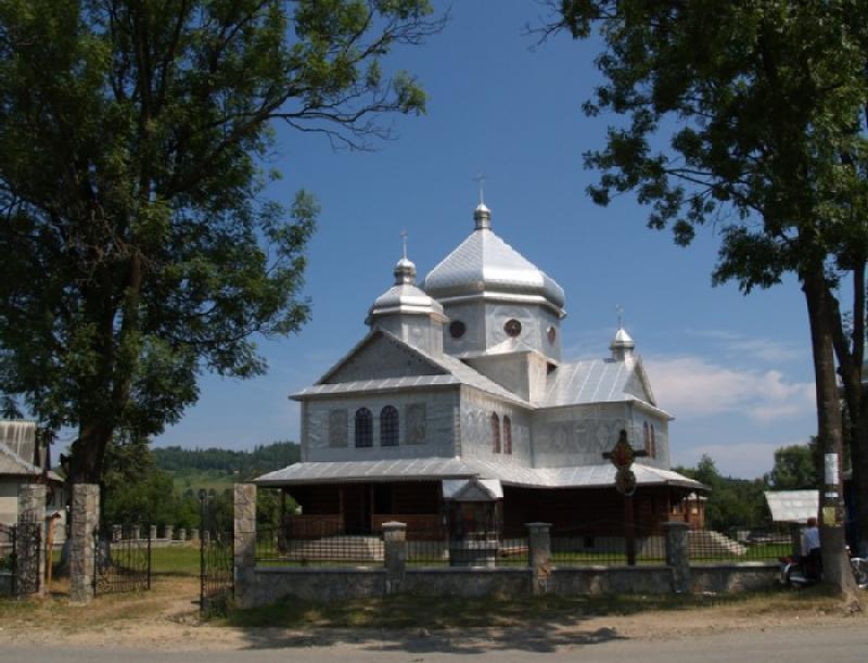
Interesting places in Evpatoria

In addition to the most popular monuments of history and architecture in the resort of Evpatoria, there is still something to look for.

Karaite kenasy

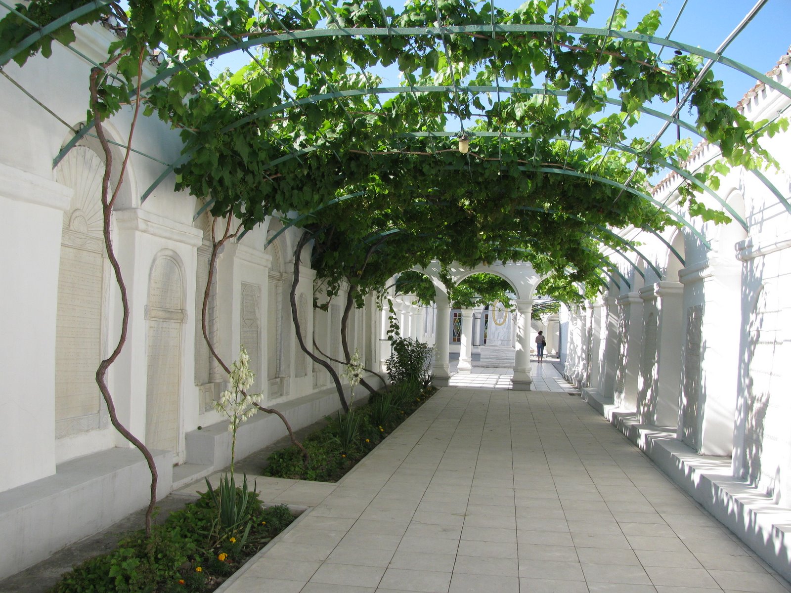
Karaite kenases & ndash; a monument of architecture, history and culture. Modern kenas buildings were built at the beginning of the last century by the project of the architects of the brothers Samuel and Solomon Babowicz. The whole complex consists of the building of the Big and Small kenas (prayer houses), the building of the religious school, the charitable canteen, the farmstead and several inner courtyards (Grape, Marble, Prayer Expectations, Ritual, Memorial). Long since it was the center of the religious life of the Karaites of Evpatoria and the Crimea. Since 1837 and before the revolution - the spiritual center of the Karaites of Russia. The most interesting marbles in the courtyards are marble fountains, 47 plates of white marble with texts cut out in ancient Biblical language. In the corner of the courtyard, formed by the eastern and northern walls, there is a granite base from the marble pillar with the sundial.

Cathedral or Cathedral kenasa & ndash; a rectangular building with separate features of Moorish architecture, has two portal with keeled arches, which are decorated with stone carvings and equipped with folding wooden doors.

Both in the Cathedral and in the Lesser Kenas there were choir races for women, which could be climbed by stairs leading from separate courtyards. Small kenasa, designed for everyday days, reminds the Cathedral in a reduced form.
During the time of its existence, kenases have been repeatedly altered. In the middle of the XIX century. Three buttresses were attached to the walls of the western and southern sides. At the end of the XIX century, the old gates were replaced with the existing ones. In the 1930s. the internal layout of the cathedral kenasy was completely changed: from a large hall a two-storeyed building was built with a dozen rooms and corridors.
In 1859, in honor of visiting the kenas by Emperor Alexander I, a marble obelisk was erected.
In 1927, both churches were closed. In 1942, during the German occupation, was opened Malaya kenasa, at the same time in the Great Kenas was reconstructed the museum of the Karaites. The last closing of the temple occurred in 1959.
In different years, various Soviet institutions were located in the buildings of the complex: an anti-religious museum, nurses' courses, sports sections, a kindergarten, a technical inventory office, a museum of local lore.
The complex of Karaite kenas is a magnificent example of the cultural architecture of the Karaite people. Perfection of architectural decisions and elegance of finishing the Evpatoria kenasy differ from similar cult constructions of this small people.
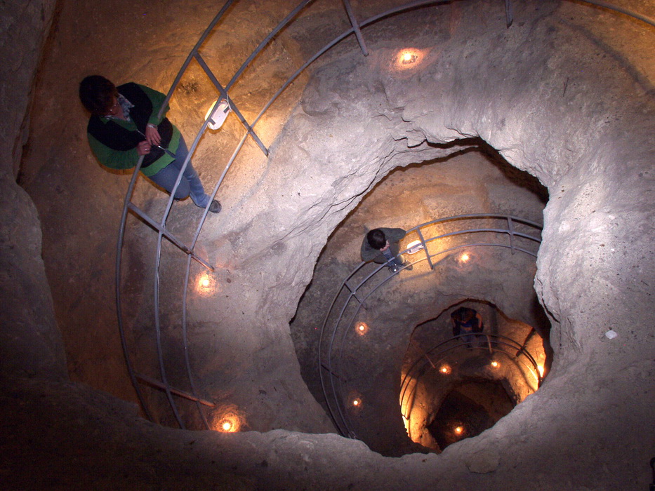
 

The Gyzlov fortress

Turkish traveler Evliya Celebi ascribes the beginning of the construction of the Gezlev fortress to the vizier of Kafa of the late 15th century Sanjivan & ndash; Pasha. Presumably built up city fortifications were in the beginning of the XVI century.

Odun Bazar Capusu (Wooden Gateway) (gate at the corner of Karaite and Karaev streets): they have a tower and a small door called Teshik, on which are carved double female breasts as an emblem.

Odun Bazar Kapusu (Wooden Bazaar Gate), were the largest of the five gates of the Tataro, Turkish Geslev, they were located in the eastern, trade & craft area of ​​the fortress. The width of the gate was more than 12 m, and the length of the passage was 13.5 m. Presumably the height of the gate is & ndash; about 20 meters.
In the 19th century the gates had another name: "Kemer-kapu & raquo; - & laquo; Arched gates & raquo ;, their aperture 3.75 m wide was covered by a cylindrical arch reinforced by arches. The height of the opening was 3.62 m. In 1947 the monument was inspected and taken into account by the Crimean Regional Committee for Construction and Architecture.
But in 1959, under the pretext that the gates impeded the traffic on Matveev Street (Karaite), they were demolished with the help of technology. Unfortunately, at the same time, the cultural layer on the territory adjacent to the monument was removed, which does not allow us to specify the dating of the structure.
Archaeological research conducted in 2003 by the West Crimean expedition of the Crimean branch of the Institute of Archeology of the National Academy of Sciences of Ukraine revealed the foundation of the gates.
Judging by the remnants of the foundation, originally the design of the gate consisted of a quadrangle of walls divided by the height of wooden interstorey floors. In the western and eastern walls, there are openings for passage. In the north and south walls with the help of arched niches were arranged for two cannon loopholes for floor fighting. The wood market in front of the gate existed already at the time of Hezlev, Evliya Celebi, who also mentions two Muslim and two Christian quarters with the Armenian church located at the eastern part of the city. In 1633 the most devastating raid by Cossacks took place on the city, which was burned and destroyed. Apparently, with this fire, you can connect the red (burnt) color of the stones of the north wall. After that, the gates are rebuilt, the passage is blocked by a semicircular vault, the walls of the passage were dismembered by three rooms on each side, also covered with arches. Instead of a wooden interfloor, the space above the archesand the niches are filled with but.

Unfortunately, as a result of archaeological work it was possible to trace only the premises of the northern half of the gate. Initially, they probably served as guard rooms, later in the 19th and 20th centuries used for shops and workshops.

Wellnear Chufut-Kale
While in Evpatoria, do not be lazy to go to the vicinity of Bakhchisarai and visit the cave city of Chufut-Kale, namely the most interesting well, discovered by archaeologists and speleologists relatively recently.

The fortress is built on a separate plateau, where there are no natural outcrops of underground water. In the past, here lived more than a thousand people, the city functioned for hundreds of years and was emptied only in the middle of the XIX century.

Despite the absence of natural underground water outcrops in the fortress, the city lived hundreds of years. The elders of the Karaites remember the delivery of drinking water to the fortress from nearby sources. For technical purposes, carefully and skillfully collected atmospheric precipitation served. However, it was known from legends, legends and books that during the siege times water was taken from a hidden hydrosystem, information about which was a military secret. Even when the fortress lost its defensive importance, the Karaites passed this secret from generation to generation.
Based on information from written and verbal sources, speleologists began searching. A small groove with a tree growing on its edge turned out to be covered with a well. The blocks of rock and soil from the well were taken out first by hand, and then by means of mechanisms for 3 years. At a 25-meter depth, a lateral entrance was found buried in the stones, gently rising upward. The connection with the well formed a large room. On its walls, in addition to the trace from the once standing water, there were inscriptions from the soot, made with Karaite italics, less often — Latin and Aramaic script. It turned out that the gallery begins from the basement of the battle tower, which, apparently, was part of the first line of defense of the fortified city. Separate sections of the arch were covered with small stalactites. On the walls were found carved plan of the dungeon and figures of people.
The junction of the vertical trunk and gallery was not yet the bottom of the well. At a depth of 27 meters, the well expanded and appeared a screw-like rock descent, which, as it cleared, led to vast reservoirs at a depth of 40 meters from the surface. Once the water from the large cracks in the walls of the structure first flowed into one of the baths, then through the drainage shed was poured into another stone tank located directly under the inlet well, and from there it was taken for use. Now the cracks are silted, and water from them practically does not arrive. On the walls of the lower hall were found niches for fixtures and while incomprehensible carved on the wall signs. After clearing the bottom of the system from clay and silt, the total depth of the well was 45 meters.

The main question that excites every visitor to an open dungeon, — who and for what was built such a complex and huge system. The main version to date is — openly powerful, the largest in the Crimea and far beyond its hydrotechnical structure, which probably served to supply water to the fortress during the siege. On the watercourses water came from large cracks in the walls of the structure first into one of the baths, then through the drainage sheds it was poured into another stone tank located directly under the inlet well, and from there it was taken for use. In extreme cases, water was raised to the level of a stepped gallery, and from there upward with the help of donkeys. In favor of this can be seen the findings of donkey horseshoes. The version of the sacred, that is, the cult purpose, also has a right to exist. Otherwise, it is difficult to explain the considerable dimensions (6.5x7 m at a height of up to 2.5 m) of the lowest hall of the system. In this case, it is possible to explain in another way baths and interpret somethe graffiti on the walls. The underground system was located near the famous monastery and the remains of other ancient Christian buildings. This underground system could be created by the Khazars or Byzantines and used until the collapse of the Khazar rule (X century), and in subsequent periods of subordination of the Golden Horde peninsula, and during the Crimean Khanate. But these are just preliminary assumptions. Perhaps the underground system operated for a short period of time and was flooded with conquerors.

Find the Best Professionals for Your Project

Expert repair, construction, and renovation specialists ready to help you right now

Recommended articles

Location from. Mykulychyn

Location from. Mykulychyn

Sightseeing Mykulychyna

Sightseeing Mykulychyna

Sights of Truskavets

Sights of Truskavets

Truskavets Nature

Truskavets Nature

More articles: